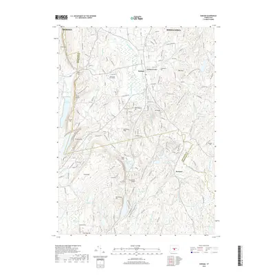
2018 Map of Durham
USGS Topo · Published 2018About this map
Durham and Durham Center serve as the primary population centers on this 2018 survey, situated within a landscape defined by the prominent Metacomet Ridge. This geologic spine creates a series of distinctive peaks including Beseck Mtn, Pistapaug Mtn, and Totoket Mtn, which dictate the local drainage patterns for the Coginchaug River and Hammonasset River. The western portion of the map is dominated by a chain of water bodies such as the Ulbrich Reservoir and Spring Brook Reservoir, while the low-lying Durham Meadows indicates the hydrologic importance of the central valley.
Find a feature on this map
66 named features on this map. Tap any name to fly to it.
Don’t see what you’re looking for? This feature index may not catch every label — zoom into the map to look around manually.
Map Details
Editions of this 2018 Durham Map
This is the sole edition of this map. No revisions or reprints were ever made.
Other maps of this area

1892 · New Haven
USGS Topo · 1:62,500

1892 · Meriden
USGS Topo · 1:62,500

1893 · Guilford
USGS Topo · 1:62,500

1893 · Middletown
USGS Topo · 1:62,500

1893 · Meriden
USGS Topo · 1:62,500

1906 · Farmington
USGS Topo · 1:125,000

1921 · New Haven
USGS Topo · 1:62,500

1928 · Cromwell
USGS Topo · 1:24,000

1943 · Durham
USGS Topo · 1:25,000

1945 · Middle Haddam
USGS Topo · 1:31,680