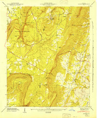
1947 Map of Durham
USGS Topo · Published 1947About this map
Lookout Mountain dominates the topography of this corner of Walker and Dade counties, creating a landscape defined by deep gaps and steep gulches. In the late 1940s, the village of Durham serves as a hub near the coal mining operations that once thrived on the plateau, connected to the valley via the Central of Georgia Road. To the west, the dramatic drop-offs of Cloudland Canyon State Park are evident, with Sitton Gulch Creek carving through the terrain near Case Cavern. The map captures a transition in Georgia's mountain economy, where rural settlements like Cassandra and Thompsonville remain centered around community landmarks like the Lookout Mtn Rural Sch and Pleasant Grove Ch. Transportation routes are strictly divided by the geography, with the Tennessee Alabama and Georgia RR following the lower elevation of Chattanooga Creek while the Scenic Highway traces the ridge top.
Find a feature on this map
70 named features on this map. Tap any name to fly to it.
Don’t see what you’re looking for? This feature index may not catch every label — zoom into the map to look around manually.
Map Details
Editions of this 1947 Durham Map
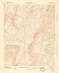
2 editions found
Other maps of this area

1886 · Ringgold
USGS Topo · 1:125,000

1886 · Stevenson
USGS Topo · 1:125,000

1892 · Ringgold
USGS Topo · 1:125,000

1892 · Stevenson
USGS Topo · 1:125,000

1895 · Stevenson
USGS Topo · 1:125,000

1935 · Durham
USGS Topo · 1:24,000

1936 · Trenton
USGS Topo · 1:24,000

1936 · Shellmound
USGS Topo · 1:24,000

1936 · Kensington
USGS Topo · 1:24,000

1936 · Hooker
USGS Topo · 1:24,000