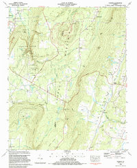
1983 Map of Durham
USGS Topo · Published 1984About this map
Lookout Mountain dominates the landscape of this 1983 survey, where the rugged terrain of northwest Georgia drops sharply into the Chattanooga Valley. The settlement of Durham and the nearby Mines reflect the region's industrial past, connected by an Old Railroad Grade that winds along the high ridges. This era captures the transition of the land toward conservation and recreation, centered on the expansive Cloudland Canyon State Park and its geological landmarks like Case Cavern and Whiteoak Spring. Local genealogy is well-preserved through numerous rural landmarks, including the Gillen Sch and a network of country churches such as New Salem Ch and Lookout Mtn Ch. From the western edge at Trenton to the eastern valley settlements of Cooper Heights and Kensington, the map documents a complex tapestry of family-named cemeteries like Hawkins Cem and Singleterry Cem tucked between gaps and gulches.
Find a feature on this map
75 named features on this map. Tap any name to fly to it.
Don’t see what you’re looking for? This feature index may not catch every label — zoom into the map to look around manually.
Map Details
Editions of this 1983 Durham Map
This is the sole edition of this map. No revisions or reprints were ever made.
Other maps of this area

1886 · Ringgold
USGS Topo · 1:125,000

1886 · Stevenson
USGS Topo · 1:125,000

1892 · Ringgold
USGS Topo · 1:125,000

1892 · Stevenson
USGS Topo · 1:125,000

1895 · Stevenson
USGS Topo · 1:125,000

1935 · Durham
USGS Topo · 1:24,000

1936 · Trenton
USGS Topo · 1:24,000

1936 · Shellmound
USGS Topo · 1:24,000

1936 · Kensington
USGS Topo · 1:24,000

1936 · Hooker
USGS Topo · 1:24,000