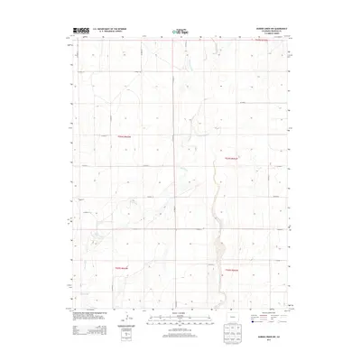
2013 Map of Durkee Creek NW
USGS Topo · Published 2013About this map
Plum Creek and Two Butte Creek carve meandering paths through the high plains of Prowers County, revealing the drainage patterns that define this agricultural landscape. The map illustrates a strictly organized section-line grid of rural routes, including CO Road AA and CO Road 28, which facilitate movement between the vast open tracts of the Colorado interior. This area is characterized by a sparse settlement pattern, where the watercourses represent the primary breaks in the geometric regularity of the Public Land Survey System. Genealogists and historians can trace the precise boundaries of townships like t024s r043w and t025s r042w, seeing how the rural road network, such as CO Road 31, follows the early 20th-century division of the land.
Find a feature on this map
21 named features on this map. Tap any name to fly to it.
Don’t see what you’re looking for? This feature index may not catch every label — zoom into the map to look around manually.
Map Details
Editions of this 2013 Durkee Creek NW Map
This is the sole edition of this map. No revisions or reprints were ever made.
Other maps of this area

1890 · Granada
USGS Topo · 1:125,000

1891 · Albany
USGS Topo · 1:125,000

1892 · Granada
USGS Topo · 1:125,000

1893 · Albany
USGS Topo · 1:125,000

1894 · Granada
USGS Topo · 1:125,000

1953 · Holly West
USGS Topo · 1:24,000

1953 · Granada
USGS Topo · 1:24,000

1953 · Holly East
USGS Topo · 1:24,000

1954 · Lamar
USGS Topo · 1:250,000

1955 · La Junta
USGS Topo · 1:250,000