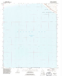
1992 Map of Durmid SE
USGS Topo · Published 1995About this map
The Salton Sea dominates this landscape, reflecting its mid-century status as both a recreational destination and a strictly controlled military and ecological zone. In 1992, the water level sat at elevation 228 feet below sea level, a measurement that anchors the various land uses along its eastern shore. The small settlement of Bertram sits along the northern edge, bordered by a topographical Dike and the sprawling Salton Sea State Recreation Area. This sheet reveals the complex administrative overlapping of the California desert, where the Salton Sea National Wildlife Refuge and the Salton Sea Test Base share space with public recreation lands, illustrating the tension between conservation, military testing, and local settlement at the end of the twentieth century.
Find a feature on this map
11 named features on this map. Tap any name to fly to it.
Don’t see what you’re looking for? This feature index may not catch every label — zoom into the map to look around manually.
Map Details
Editions of this 1992 Durmid SE Map
This is the sole edition of this map. No revisions or reprints were ever made.
Other maps of this area

1940 · Kane Spring
USGS Topo · 1:62,500

1940 · Frink
USGS Topo · 1:62,500

1940 · Durmid
USGS Topo · 1:62,500

1944 · Durmid
USGS Topo · 1:62,500

1944 · Kane Spring
USGS Topo · 1:62,500

1944 · Calipatria
USGS Topo · 1:62,500

1944 · Frink
USGS Topo · 1:62,500

1954 · Salton Sea
USGS Topo · 1:250,000

1955 · Salton Sea
USGS Topo · 1:250,000

1956 · Frink NW
USGS Topo · 1:24,000