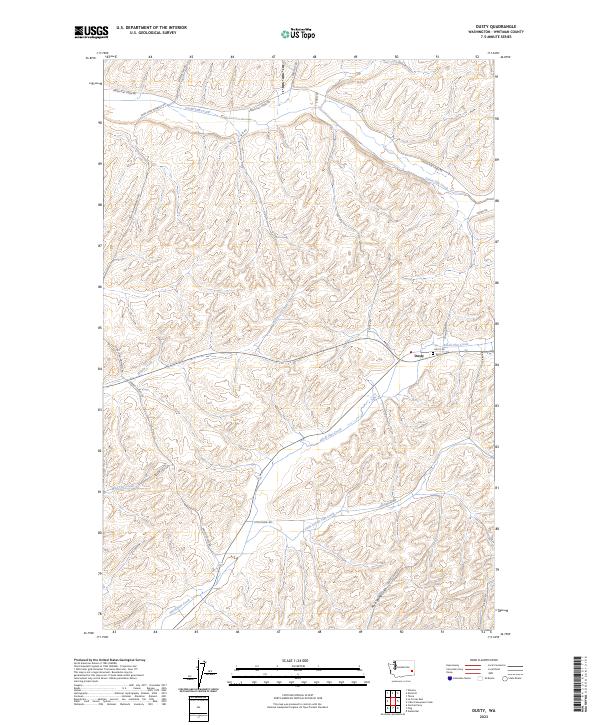
2023 Map of Dusty
USGS Topo · Published 2023About this map
Dusty serves as the central hub of this agricultural landscape in Whitman County, situated where the drainages of Willow Creek and Alkali Flat Creek converge. The terrain is defined by the intricate dendritic drainage patterns of the Palouse, where seasonal waterways like Mud Flat Creek and Little Alkali Flat Creek have carved deep coulees into the loess hills. These natural corridors dictate the modern transportation network, with routes such as Dusty Rd following the water's edge.
Find a feature on this map
25 named features on this map. Tap any name to fly to it.
Don’t see what you’re looking for? This feature index may not catch every label — zoom into the map to look around manually.
Map Details
Editions of this 2023 Dusty Map
This is the sole edition of this map. No revisions or reprints were ever made.
Other maps of this area

1950 · La Crosse
USGS Topo · 1:62,500

1950 · Penawawa
USGS Topo · 1:62,500

1950 · Endicott
USGS Topo · 1:62,500

1950 · Hay
USGS Topo · 1:62,500

1952 · Hay
USGS Topo · 1:62,500

1952 · La Crosse
USGS Topo · 1:62,500

1955 · Pullman
USGS Topo · 1:250,000

1958 · Pullman
USGS Topo · 1:250,000

1981 · Dusty
USGS Topo · 1:24,000
1981 · Central Ferry
USGS Topo · 1:24,000