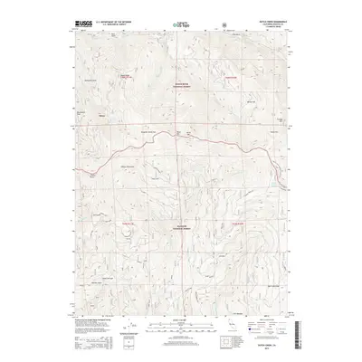
2015 Map of Dutch Creek
USGS Topo · Published 2015About this map
The Siskiyou Mountains define the character of this high-elevation terrain where the Rogue River National Forest meets the Klamath National Forest. The landscape is a network of named ridges and deep gulches, including Nabob Ridge, Salt Gulch, and Panther Gulch. Significant human markers in these remote reaches include Johnsons Dairy and the Copper Horse mine site, which suggest a history of high-country agriculture and resource extraction. The eastern edge of the map features a section of the Pacific Crest National Scenic Trail as it traverses toward Onion Flat. Small settlements and outposts like Eileen and Reeves Ranch Springs are positioned near local water sources such as Joe Cr and Dutch Creek, highlighting the importance of the drainage system in navigating and settling this part of Siskiyou County.
Find a feature on this map
41 named features on this map. Tap any name to fly to it.
Don’t see what you’re looking for? This feature index may not catch every label — zoom into the map to look around manually.
Map Details
Editions of this 2015 Dutch Creek Map
This is the sole edition of this map. No revisions or reprints were ever made.
Other maps of this area

1886 · Shasta
USGS Topo · 1:250,000

1891 · Ashland
USGS Topo · 1:250,000

1893 · Ashland
USGS Topo · 1:250,000

1894 · Shasta
USGS Topo · 1:250,000

1897 · Ashland
USGS Topo · 1:250,000

1908 · Grants Pass
USGS Topo · 1:125,000

1914 · Seiad
USGS Topo · 1:125,000

1922 · Seiad
USGS Topo · 1:125,000

1932 · Yreka
USGS Topo · 1:96,000

1938 · Medford
USGS Topo · 1:125,000