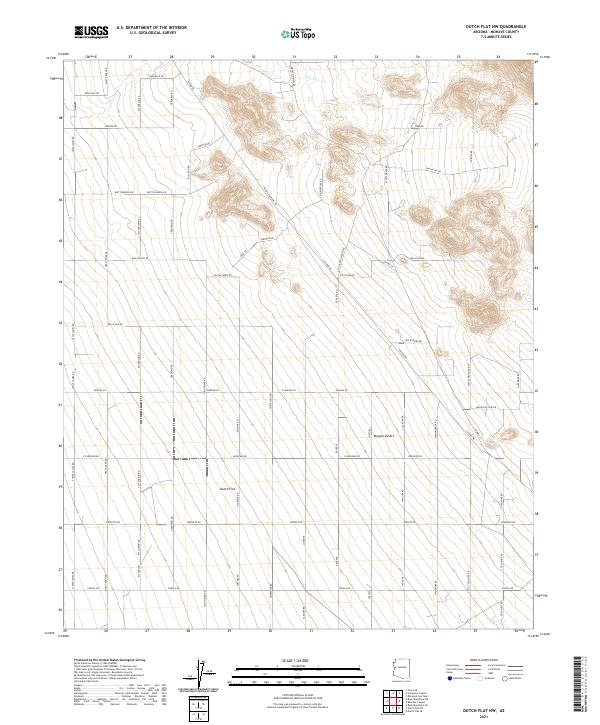
2021 Map of Dutch Flat NW
USGS Topo · Published 2021About this map
Dutch Flat and the surrounding Mojave Desert terrain define this landscape in Mohave County, where a grid of modern desert roads bears the names of figures from Old West lore. The map shows a transition from the lower alluvial plains of the flat toward the rising foothills of the Hualapai Mountains. Transportation through this arid region is marked by a network of residential and access roads such as Wyatt Earp Rd, Kit Carson Rd, and Jesse James Rd.
Find a feature on this map
67 named features on this map. Tap any name to fly to it.
Don’t see what you’re looking for? This feature index may not catch every label — zoom into the map to look around manually.
Map Details
Editions of this 2021 Dutch Flat NW Map
This is the sole edition of this map. No revisions or reprints were ever made.
Other maps of this area

1923 · Signal
USGS Topo · 1:250,000

1927 · Yucca
USGS Topo · 1:62,500

1927 · Buck Mountains
USGS Topo · 1:62,500

1929 · Buck Mountains
USGS Topo · 1:62,500

1929 · Yucca
USGS Topo · 1:62,500

1942 · Signal
USGS Topo · 1:250,000

1950 · Prescott
USGS Topo · 1:250,000

1954 · Needles
USGS Topo · 1:250,000

1954 · Prescott
USGS Topo · 1:250,000

1956 · Needles
USGS Topo · 1:250,000