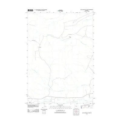
2012 Map of Dutch Nick Flat SW
USGS Topo · Published 2012About this map
Paradise Alley and East Ridge define the landscape of this high-plains region in Washakie County. The drainage network is particularly prominent, centered on the Middle Fork Fifteenmile Cr and the S Fork Fifteenmile Cr, which carve through the arid terrain. Human intervention in this water-scarce environment is visible through the presence of the Perkins Ditch, an irrigation feature drawing from Gooseberry Cr in the southern portion of the map. Navigation through this territory relies on a few primary routes, including Dutch Nick Rd and Squaw Teats Rd, which connect the isolated ridges and draws. In the far southwest corner, Murphy Draw marks the edge of this vast rangeland, providing a detailed look at the hydrology and land-use patterns of modern Wyoming ranching and resource management.
Find a feature on this map
12 named features on this map. Tap any name to fly to it.
Don’t see what you’re looking for? This feature index may not catch every label — zoom into the map to look around manually.
Map Details
Editions of this 2012 Dutch Nick Flat SW Map
This is the sole edition of this map. No revisions or reprints were ever made.
Other maps of this area

1913 · Grass Creek Basin
USGS Topo · 1:62,500

1914 · Blue Mesa
USGS Topo · 1:62,500

1915 · Grass Creek Basin
USGS Topo · 1:62,500

1916 · Blue Mesa
USGS Topo · 1:62,500

1951 · Sucker Dam
USGS Topo · 1:24,000

1951 · Dutch Nick Flat
USGS Topo · 1:24,000

1951 · Dutch Nick Flat SW
USGS Topo · 1:24,000

1951 · Gillies Draw
USGS Topo · 1:24,000

1951 · Dead Indian Hill
USGS Topo · 1:24,000

1951 · Dutch Nick Flat NW
USGS Topo · 1:24,000