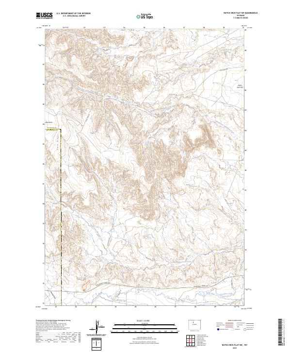
2023 Map of Dutch Nick Flat SW
USGS Topo · Published 2023About this map
Middle Fork Fifteenmile Creek and the South Fork Fifteenmile Creek carve through this high desert landscape, defining the drainage patterns south of Dutch Nick Flat. The terrain is marked by distinctive local landmarks such as Paradise Alley and Bull Knoll, while the western edge is bounded by the prominent East Ridge. This area shows a clear reliance on water management for ranching or agricultural use, evidenced by the presence of Steele Ditch and Perkins Ditch near Gooseberry Creek. Transportation in this portion of Washakie County is primarily facilitated by rural routes like Dutch Nick Rd and Gooseberry Creek Rd, which follow the natural contours of the draws and creek beds.
Find a feature on this map
20 named features on this map. Tap any name to fly to it.
Don’t see what you’re looking for? This feature index may not catch every label — zoom into the map to look around manually.
Map Details
Editions of this 2023 Dutch Nick Flat SW Map
This is the sole edition of this map. No revisions or reprints were ever made.
Other maps of this area

1913 · Grass Creek Basin
USGS Topo · 1:62,500

1914 · Blue Mesa
USGS Topo · 1:62,500

1915 · Grass Creek Basin
USGS Topo · 1:62,500

1916 · Blue Mesa
USGS Topo · 1:62,500

1951 · Sucker Dam
USGS Topo · 1:24,000

1951 · Dutch Nick Flat
USGS Topo · 1:24,000

1951 · Dutch Nick Flat SW
USGS Topo · 1:24,000

1951 · Gillies Draw
USGS Topo · 1:24,000

1951 · Dead Indian Hill
USGS Topo · 1:24,000

1951 · Dutch Nick Flat NW
USGS Topo · 1:24,000