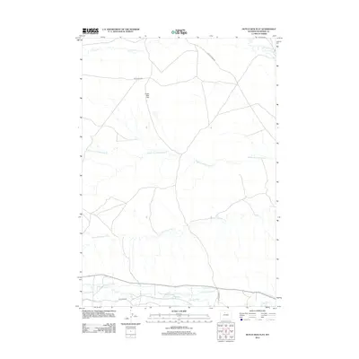
2012 Map of Dutch Nick Flat
USGS Topo · Published 2012About this map
Dutch Nick Flat defines the open landscape of this Washakie County terrain, where a complex network of seasonal watercourses and irrigation infrastructure supports the high desert environment. The drainage system of Fifteenmile Cr and its many branches, including Middle Fork Fifteenmile Cr and S Fork Fifteenmile Cr, crisscross the territory. In the southern portion of the quadrangle, the concentration of man-made waterways like Holder Ditch, Peterson Ditch, and Steel Ditch along Gooseberry Cr illustrates the long-standing importance of water management in this region. This 2012 survey also documents industrial and transit corridors, such as Platte Pipeline Rd and Blue Mesa Rd, which provide access through the arid stretches between the creek beds and flatlands.
Find a feature on this map
15 named features on this map. Tap any name to fly to it.
Don’t see what you’re looking for? This feature index may not catch every label — zoom into the map to look around manually.
Map Details
Editions of this 2012 Dutch Nick Flat Map
This is the sole edition of this map. No revisions or reprints were ever made.
Other maps of this area

1914 · Blue Mesa
USGS Topo · 1:62,500

1916 · Blue Mesa
USGS Topo · 1:62,500

1945 · Kirby
USGS Topo · 1:62,500

1946 · Kirby
USGS Topo · 1:62,500

1951 · Sucker Dam
USGS Topo · 1:24,000

1951 · Dutch Nick Flat
USGS Topo · 1:24,000

1951 · Schuster Flats
USGS Topo · 1:24,000

1951 · Schuster Flats NW
USGS Topo · 1:24,000

1951 · Dutch Nick Flat SW
USGS Topo · 1:24,000

1951 · Dutch Nick Flat NW
USGS Topo · 1:24,000