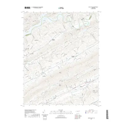
2019 Map of Dutch Valley
USGS Topo · Published 2019About this map
Clinch Mountain and Hinds Ridge define the northeast-to-southwest orientation of this East Tennessee landscape. The topography creates a series of parallel valleys, including Potato Valley, Clinch Valley, and Poor Valley, each hosting its own network of springs and streams like Richland Cr and Flat Cr. Settlement patterns follow these lowlands, with concentrations at Rutledge and Washburn. The map reveals a high density of small family burial grounds, such as Arnwine Cem, Kitts Cem, and Seymore Cem, reflecting the deep-rooted genealogical history of Grainger and Claiborne counties.
Find a feature on this map
89 named features on this map. Tap any name to fly to it.
Don’t see what you’re looking for? This feature index may not catch every label — zoom into the map to look around manually.
Map Details
Editions of this 2019 Dutch Valley Map
This is the sole edition of this map. No revisions or reprints were ever made.
Other maps of this area

1883 · Morristown
USGS Topo · 1:125,000

1893 · Morristown
USGS Topo · 1:125,000

1895 · Morristown
USGS Topo · 1:125,000

1897 · Maynardville
USGS Topo · 1:125,000

1900 · Maynardville
USGS Topo · 1:125,000

1935 · Luttrell
USGS Topo · 1:24,000

1935 · Tate Springs
USGS Topo · 1:48,000

1935 · Straw Plains
USGS Topo · 1:48,000

1935 · Joppa
USGS Topo · 1:24,000

1935 · Howard Quarter
USGS Topo · 1:24,000