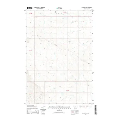
2014 Map of Dutchman Creek
USGS Topo · Published 2014About this map
The Blue Mud Hills dominate the northern horizon of this landscape in Carter County, Montana, where a complex network of ephemeral drainages carves through the high plains. The terrain is defined by the convergence of several major creek systems, most notably Dutchman Cr, Cabin Cr, and the extensive branching of the Corral Creek watershed. This 2014 survey reveals a territory almost entirely devoid of concentrated settlements, instead showing the sparse infrastructure of ranching country. The presence of Ridgeway Ridge Rd provides the primary transit corridor across the central and eastern portions of the map. Tracing the paths of N Fork Corral Cr, S Fork Corral Cr, and Flat Cr across the township and range lines illustrates the natural drainage patterns that have historically dictated land use and property boundaries in this corner of the state.
Find a feature on this map
16 named features on this map. Tap any name to fly to it.
Don’t see what you’re looking for? This feature index may not catch every label — zoom into the map to look around manually.
Map Details
Editions of this 2014 Dutchman Creek Map
This is the sole edition of this map. No revisions or reprints were ever made.
Other maps of this area

1954 · Ekalaka
USGS Topo · 1:250,000

1956 · Ekalaka
USGS Topo · 1:250,000

1958 · Ekalaka
USGS Topo · 1:250,000

1965 · Ekalaka
USGS Topo · 1:250,000

1979 · W L Butte
USGS Topo · 1:24,000

1979 · Dutchman Creek
USGS Topo · 1:24,000

1979 · Dead Boy Divide
USGS Topo · 1:24,000

1979 · Ikey Creek
USGS Topo · 1:24,000

1979 · Chalk Buttes
USGS Topo · 1:24,000
1979 · Davis Creek East
USGS Topo · 1:24,000