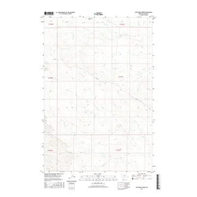
2017 Map of Dutchman Creek
USGS Topo · Published 2017About this map
The Blue Mud Hills rise above a deeply dissected landscape in Carter County, defined by an intricate network of intermittent drainages. This high-plains terrain is oriented around several primary watercourses, including Dutchman Cr, Cabin Cr, and Schultz Cr in the north, while the southern portion of the quadrangle is dominated by the branching system of Corral Cr, which includes the N Fork Corral Cr and S Fork Corral Cr. The transport network is sparse, centered on the aptly named Ridge Rd which follows the higher ground between creek basins. This survey illustrates the classic western public land survey system, with the topography divided into regular townships such as t3s r57e and t4s r56e. It is a landscape shaped by erosion and elevation, where seasonal water flow dictates the geography of the Montana plains.
Find a feature on this map
16 named features on this map. Tap any name to fly to it.
Don’t see what you’re looking for? This feature index may not catch every label — zoom into the map to look around manually.
Map Details
Editions of this 2017 Dutchman Creek Map
This is the sole edition of this map. No revisions or reprints were ever made.
Other maps of this area

1954 · Ekalaka
USGS Topo · 1:250,000

1956 · Ekalaka
USGS Topo · 1:250,000

1958 · Ekalaka
USGS Topo · 1:250,000

1965 · Ekalaka
USGS Topo · 1:250,000

1979 · W L Butte
USGS Topo · 1:24,000

1979 · Dutchman Creek
USGS Topo · 1:24,000

1979 · Dead Boy Divide
USGS Topo · 1:24,000

1979 · Ikey Creek
USGS Topo · 1:24,000

1979 · Chalk Buttes
USGS Topo · 1:24,000
1979 · Davis Creek East
USGS Topo · 1:24,000