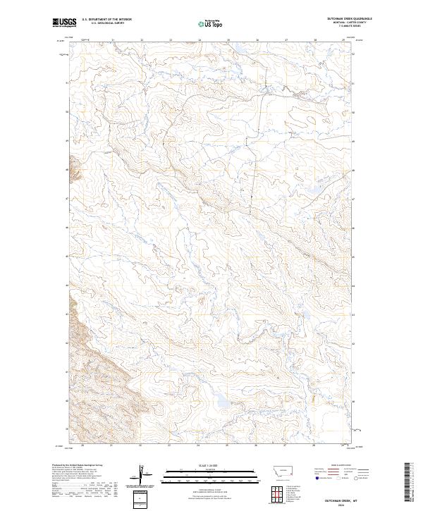
2024 Map of Dutchman Creek
USGS Topo · Published 2024About this map
Dutchman Creek and its complex network of seasonal tributaries define this corner of Carter County, Montana. The landscape is heavily dissected by the upper reaches of North Fork Corral Creek and South Fork Corral Creek, showing a rugged drainage pattern typical of the eastern plains' broken country. This area, dominated by ranching and public land management, is accessed primarily via Ridge Rd, which follows the high ground between the various creek basins. The map illustrates the hydrological importance of smaller drainages like Schultz Creek and Flat Creek in an arid environment where water sources dictated early land use and settlement patterns. Local history is tied closely to these named waterways and the ridgelines that separate the Cabin Creek drainage from the Corral Creek system to the south.
Find a feature on this map
15 named features on this map. Tap any name to fly to it.
Don’t see what you’re looking for? This feature index may not catch every label — zoom into the map to look around manually.
Map Details
Editions of this 2024 Dutchman Creek Map
This is the sole edition of this map. No revisions or reprints were ever made.
Other maps of this area

1954 · Ekalaka
USGS Topo · 1:250,000

1956 · Ekalaka
USGS Topo · 1:250,000

1958 · Ekalaka
USGS Topo · 1:250,000

1965 · Ekalaka
USGS Topo · 1:250,000

1979 · W L Butte
USGS Topo · 1:24,000

1979 · Dutchman Creek
USGS Topo · 1:24,000

1979 · Dead Boy Divide
USGS Topo · 1:24,000

1979 · Ikey Creek
USGS Topo · 1:24,000

1979 · Chalk Buttes
USGS Topo · 1:24,000
1979 · Davis Creek East
USGS Topo · 1:24,000