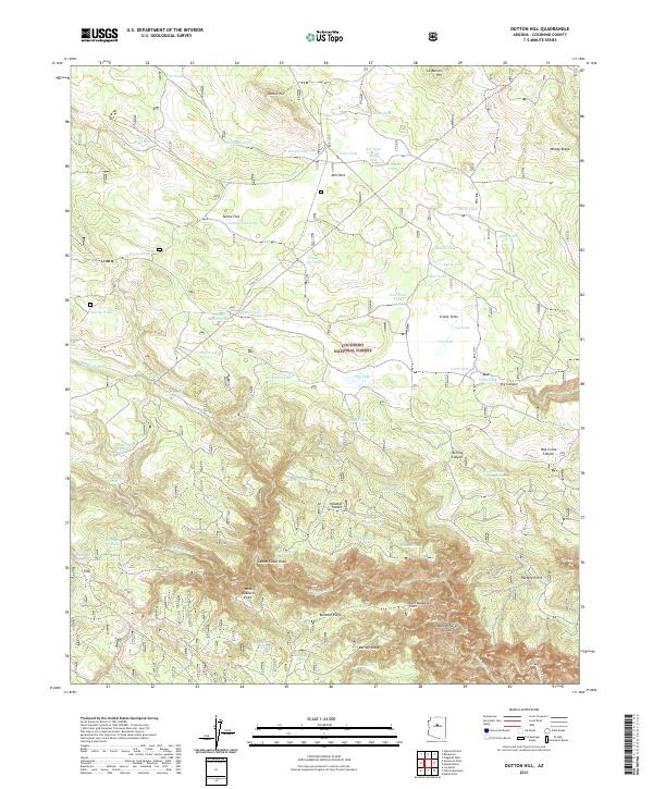
2021 Map of Dutton Hill
USGS Topo · Published 2021About this map
Coconino National Forest terrain dominates this survey of the high plateau country south of Flagstaff. The landscape is defined by a sophisticated network of man-made water catchments, including John Tank, Jim Bean Tank, and Mary Tank, which support ranching and wildlife in an area where permanent surface water is scarce. The southern portion of the map reveals the dramatic transition from the plateau into the deep drainage systems of Oak Creek Canyon and Sterling Canyon. Prominent landmarks such as Dutton Hill and the ridge line of Woody Ridge provide elevation, while the western edge is marked by notable depressions like Horse Trap Sink and the geologic features of Crater Sinks. This era of management is characterized by Forest Service infrastructure and fire access roads, including Co RD 231, which connects isolated locations like Howard Pocket and Casner Cabin Draw.
Find a feature on this map
74 named features on this map. Tap any name to fly to it.
Don’t see what you’re looking for? This feature index may not catch every label — zoom into the map to look around manually.
Map Details
Editions of this 2021 Dutton Hill Map
This is the sole edition of this map. No revisions or reprints were ever made.
Other maps of this area

1886 · San Francisco Mtns
USGS Topo · 1:250,000

1887 · Verde
USGS Topo · 1:250,000

1891 · San Francisco Mtns
USGS Topo · 1:250,000

1892 · Verde
USGS Topo · 1:250,000

1894 · San Francisco Mtns
USGS Topo · 1:250,000

1899 · San Francisco Mtns
USGS Topo · 1:250,000

1908 · Flagstaff
USGS Topo · 1:125,000

1912 · Flagstaff
USGS Topo · 1:125,000

1923 · Camp Verde
USGS Topo · 1:125,000

1932 · Camp Verde
USGS Topo · 1:125,000