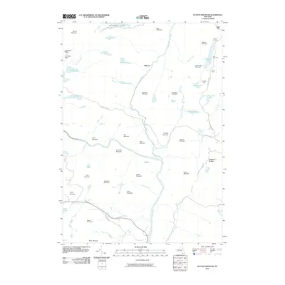
2010 Map of Dutton Mountain
USGS Topo · Published 2010About this map
Boreas River and the upper reaches of the Hudson River define this high-altitude landscape in Chester, New York. In the northern reaches, the isolated settlement of Stillwater and the Moose Pond Club sit amidst a dense network of water bodies including Moose Pond, Fish Pond, and Grassy Pond. The eastern edge of the map shows a more developed recreational and transit corridor, where State Hwy 28N Scn passes by Balfour Lake and the grounds of Camp Che-na-wah and Camp Baco.
Find a feature on this map
59 named features on this map. Tap any name to fly to it.
Don’t see what you’re looking for? This feature index may not catch every label — zoom into the map to look around manually.
Map Details
Editions of this 2010 Dutton Mountain Map
This is the sole edition of this map. No revisions or reprints were ever made.
Other maps of this area

1895 · North Creek
USGS Topo · 1:62,500

1897 · North Creek
USGS Topo · 1:62,500

1897 · Schroon Lake
USGS Topo · 1:62,500

1898 · Newcomb
USGS Topo · 1:62,500

1898 · Thirteenth Lake
USGS Topo · 1:62,500

1901 · Newcomb
USGS Topo · 1:62,500

1950 · Glens Falls
USGS Topo · 1:250,000

1950 · Utica
USGS Topo · 1:250,000

1953 · Schroon Lake
USGS Topo · 1:62,500

1954 · Newcomb
USGS Topo · 1:62,500