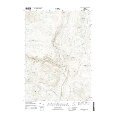
2016 Map of Dutton Mountain
USGS Topo · Published 2016About this map
Stillwater and the secluded hamlet of Pudding Hollow anchor this Adirondack landscape where the Hudson River carves a winding path through the borderlands of Hamilton and Essex counties. The terrain is defined by a dense network of water and peaks, including the high waters of Balfour Lake and the isolated Black Mountain Ponds. Traditional access routes like Northwoods Club Rd and Moose Pond Club Rd provide the primary infrastructure through the heavy timber and high ridges of Dutton Mtn and Baldface Mtn. The map reveals a land shaped by its hydrography, from the rushing Boreas River to small, tucked-away features like O K Slip Pond and Prier Pond. Local industrial history is whispered through names like Crusher Hill, indicating a history of resource extraction amidst the wilderness.
Find a feature on this map
68 named features on this map. Tap any name to fly to it.
Don’t see what you’re looking for? This feature index may not catch every label — zoom into the map to look around manually.
Map Details
Editions of this 2016 Dutton Mountain Map
This is the sole edition of this map. No revisions or reprints were ever made.
Other maps of this area

1895 · North Creek
USGS Topo · 1:62,500

1897 · North Creek
USGS Topo · 1:62,500

1897 · Schroon Lake
USGS Topo · 1:62,500

1898 · Newcomb
USGS Topo · 1:62,500

1898 · Thirteenth Lake
USGS Topo · 1:62,500

1901 · Newcomb
USGS Topo · 1:62,500

1950 · Glens Falls
USGS Topo · 1:250,000

1950 · Utica
USGS Topo · 1:250,000

1953 · Schroon Lake
USGS Topo · 1:62,500

1954 · Newcomb
USGS Topo · 1:62,500