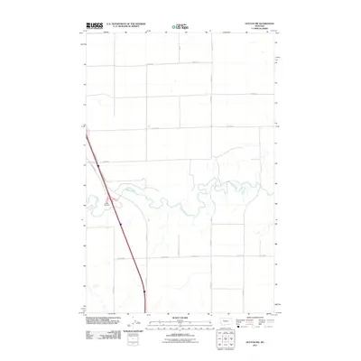
2011 Map of Dutton NW
USGS Topo · Published 2011About this map
The Teton River meanders across this Teton County landscape, carving a serpentine path through a region defined by its rigid, gridded agricultural layout. Surveyed in 2011, this quadrangle illustrates the intersection of natural hydrology and modern transit, most notably where the river's loops contrast with the straight lines of rural thoroughfares like 26th Rd NE and 20th Rd NE. The western edge of the map is dominated by a primary transportation corridor, featuring E Frontage Rd and the Dutton Rest Area. This infrastructure supports the agricultural operations connected by an organized system of lanes, such as 15th Ln NE and 13th Ln NE, which segment the vast plains into productive sections. The map provides a clear record of land use and water management in the early 21st century.
Find a feature on this map
13 named features on this map. Tap any name to fly to it.
Don’t see what you’re looking for? This feature index may not catch every label — zoom into the map to look around manually.
Map Details
Editions of this 2011 Dutton NW Map
This is the sole edition of this map. No revisions or reprints were ever made.
Other maps of this area

1886 · Great Falls
USGS Topo · 1:250,000

1920 · Conrad
USGS Topo · 1:125,000

1950 · Dutton
USGS Topo · 1:62,500

1950 · Collins
USGS Topo · 1:62,500

1954 · Great Falls
USGS Topo · 1:250,000

1954 · Shelby
USGS Topo · 1:250,000

1957 · Great Falls
USGS Topo · 1:250,000

1958 · Shelby
USGS Topo · 1:250,000

1967 · Brady
USGS Topo · 1:24,000

1967 · Fowler Coulee SW
USGS Topo · 1:24,000