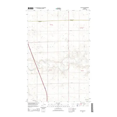
2014 Map of Dutton NW
USGS Topo · Published 2014About this map
The Teton River cuts a winding path across this portion of the Montana plains, creating a significant break in the otherwise regular grid of the Public Land Survey System. This 2014 survey documents the agricultural and transportation layout along the border of Pondera Co and Teton Co. The landscape is defined by the sharp contrast between the flat upland benches, systematically divided by routes such as Meridian Rd and 26th Rd, and the deep, eroded drainage patterns of Railroad Coulee and Hunt Coulee. These coulees illustrate the natural erosion of the plains toward the river basin. Modern infrastructure is represented by the path of I-15 N, which bisects the western sections, providing a primary transit corridor through this rural landscape of high-plains agriculture.
Find a feature on this map
23 named features on this map. Tap any name to fly to it.
Don’t see what you’re looking for? This feature index may not catch every label — zoom into the map to look around manually.
Map Details
Editions of this 2014 Dutton NW Map
This is the sole edition of this map. No revisions or reprints were ever made.
Other maps of this area

1886 · Great Falls
USGS Topo · 1:250,000

1920 · Conrad
USGS Topo · 1:125,000

1950 · Dutton
USGS Topo · 1:62,500

1950 · Collins
USGS Topo · 1:62,500

1954 · Great Falls
USGS Topo · 1:250,000

1954 · Shelby
USGS Topo · 1:250,000

1957 · Great Falls
USGS Topo · 1:250,000

1958 · Shelby
USGS Topo · 1:250,000

1967 · Brady
USGS Topo · 1:24,000

1967 · Fowler Coulee SW
USGS Topo · 1:24,000