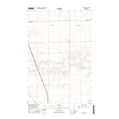
2017 Map of Dutton NW
USGS Topo · Published 2017About this map
The Teton River carves a winding path through the heart of this Teton County landscape, where the high plains transition into deeply incised coulees. The terrain is structured by the Public Land Survey System, with the boundary between t26n r1w and t26n r1e dividing the northern section. Agricultural and ranching infrastructure is evident through a grid of rural routes such as 26th Rd NE and 24th Rd NE, which intersect the expansive topography of the Golden Triangle region. In the south, the drainage patterns of Railroad Coulee and Hunt Coulee signify the complex water management and natural runoff systems vital to this semi-arid environment. The presence of E Frontage Rd running parallel to the main corridor suggests the modern transportation evolution of this rural Montana territory.
Find a feature on this map
19 named features on this map. Tap any name to fly to it.
Don’t see what you’re looking for? This feature index may not catch every label — zoom into the map to look around manually.
Map Details
Editions of this 2017 Dutton NW Map
This is the sole edition of this map. No revisions or reprints were ever made.
Other maps of this area

1886 · Great Falls
USGS Topo · 1:250,000

1920 · Conrad
USGS Topo · 1:125,000

1950 · Dutton
USGS Topo · 1:62,500

1950 · Collins
USGS Topo · 1:62,500

1954 · Great Falls
USGS Topo · 1:250,000

1954 · Shelby
USGS Topo · 1:250,000

1957 · Great Falls
USGS Topo · 1:250,000

1958 · Shelby
USGS Topo · 1:250,000

1967 · Brady
USGS Topo · 1:24,000

1967 · Fowler Coulee SW
USGS Topo · 1:24,000