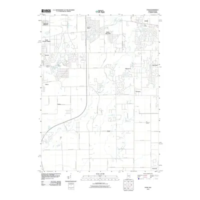
2010 Map of Dyer
USGS Topo · Published 2010About this map
Plum Creek and its southern tributaries wind through this borderland corridor, illustrating the transition from the dense suburban grids of Chicago Heights and Sauk Village into the more dispersed rural landscape of eastern Illinois and western Indiana. The map captures a moment in the late 2000s when residential development was pressing against established agricultural tracts, particularly around Saint John and Dyer. This era shows a community defined by its arterial connections, such as the Bishop Ford Freeway, while maintaining historical anchors like Saint James Catholic Cemetery and the more remote Eagle Lake Cemetery. To the south, smaller crossroads like Faithorn and Kreitzburg remain distinct points on the landscape, and recreational sites such as Camp Crete and the Lincoln Oaks Golf Course offer a counterpoint to the growing residential footprint near Deer Lake.
Find a feature on this map
66 named features on this map. Tap any name to fly to it.
Don’t see what you’re looking for? This feature index may not catch every label — zoom into the map to look around manually.
Map Details
Editions of this 2010 Dyer Map
This is the sole edition of this map. No revisions or reprints were ever made.
Other maps of this area

1892 · Calumet
USGS Topo · 1:62,500

1893 · Calumet
USGS Topo · 1:62,500

1900 · Toleston
USGS Topo · 1:62,500

1900 · Calumet
USGS Topo · 1:62,500

1901 · Calumet
USGS Topo · 1:62,500

1929 · Calumet City
USGS Topo · 1:24,000

1929 · Harvey
USGS Topo · 1:24,000

1929 · Dyer
USGS Topo · 1:24,000

1930 · Dyer
USGS Topo · 1:24,000

1930 · Steger
USGS Topo · 1:24,000