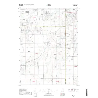
2019 Map of Dyer
USGS Topo · Published 2019About this map
Chicago Heights and Sauk Village anchor this landscape along the Illinois-Indiana border, where suburban development meets the agricultural reaches of Cook and Will counties. The modern footprint of the Bishop Ford Freeway bisects the area, yet the map preserves a deep record of local heritage through its numerous denominational burial grounds. Genealogists can locate Saint James Catholic Cem, Saint Joseph Cem, and the Saint John's Lutheran Church Cem near the state line. South of the more densely settled corridors of Lynwood and Dyer, the terrain transitions to the drainage basins of Plum Cr and the Lansing Drainage Ditch. Smaller, more isolated settlements like Kreitzburg and Faithorn reflect the historical rural character that persists alongside established cemeteries like Beebe's Grove Cem and Zion United Church of Christ Cem.
Find a feature on this map
220 named features on this map. Tap any name to fly to it.
Don’t see what you’re looking for? This feature index may not catch every label — zoom into the map to look around manually.
Map Details
Editions of this 2019 Dyer Map
This is the sole edition of this map. No revisions or reprints were ever made.
Other maps of this area

1892 · Calumet
USGS Topo · 1:62,500

1893 · Calumet
USGS Topo · 1:62,500

1900 · Toleston
USGS Topo · 1:62,500

1900 · Calumet
USGS Topo · 1:62,500

1901 · Calumet
USGS Topo · 1:62,500

1929 · Calumet City
USGS Topo · 1:24,000

1929 · Harvey
USGS Topo · 1:24,000

1929 · Dyer
USGS Topo · 1:24,000

1930 · Dyer
USGS Topo · 1:24,000

1930 · Steger
USGS Topo · 1:24,000