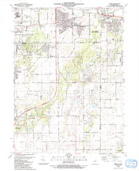
1990 Map of Dyer
USGS Topo · Published 1991About this map
The Illinois and Indiana state line bisects this landscape of expanding residential grids and preserved natural corridors. The town of Dyer and the community of Sauk Village serve as primary anchors in the north, while smaller settlements like Kreitzburg and Brunswick maintain a more rural character further south. The Sauk Trail and Calumet Expressway indicate the heavy influence of regional transit, yet the presence of the Plum Creek Forest Preserve and Goodenow Grove Forest Preserve suggests a deliberate effort to maintain green space amidst the development of Steger and Crete.
Find a feature on this map
61 named features on this map. Tap any name to fly to it.
Don’t see what you’re looking for? This feature index may not catch every label — zoom into the map to look around manually.
Map Details
Editions of this 1990 Dyer Map
This is the sole edition of this map. No revisions or reprints were ever made.
Other maps of this area

1892 · Calumet
USGS Topo · 1:62,500

1893 · Calumet
USGS Topo · 1:62,500

1900 · Toleston
USGS Topo · 1:62,500

1900 · Calumet
USGS Topo · 1:62,500

1901 · Calumet
USGS Topo · 1:62,500

1929 · Calumet City
USGS Topo · 1:24,000

1929 · Harvey
USGS Topo · 1:24,000

1929 · Dyer
USGS Topo · 1:24,000

1930 · Dyer
USGS Topo · 1:24,000

1930 · Steger
USGS Topo · 1:24,000