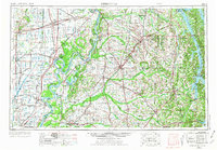
2022 Map of Dyersburg
USGS Topo · Published 2022About this map
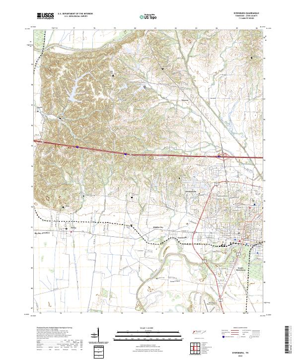
The Obion River defines the northern reaches of this West Tennessee landscape, where the flat river bottom gives way to the prominent Chickasaw Bluff. This 2022 survey details the complex geography between the Obion and the North Fork Forked Deer River, showing a region defined by agricultural drainage systems like the Crockett Cr Drainage Ditch and Lewis Cr Drainage Ditch. The city of Dyersburg serves as the regional hub, anchored by the Dyer County Courthouse and Dyersburg State Community College. Smaller outlying settlements including Finley, Nauvoo, and Lenox are connected by a dense network of county roads. For genealogists, the map is particularly detailed, locating numerous small family and community burial grounds such as Light Family Cem, Neely Chapel Cem, and Hopewell Cem. The transition from the rugged terrain of Peel Hollow to the industrial and aviation footprint of the Dyersburg Regional Airport illustrates the varied land use of modern Dyer County.
Find a feature on this map
149 named features on this map. Tap any name to fly to it.
Don’t see what you’re looking for? This feature index may not catch every label — zoom into the map to look around manually.
Map Details
Editions of this 2022 Dyersburg Map
This is the sole edition of this map. No revisions or reprints were ever made.
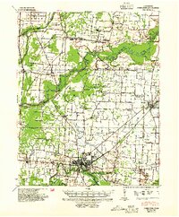
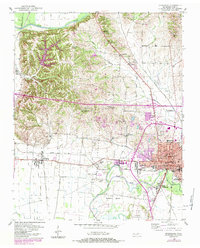
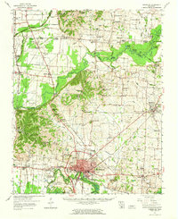
Historical Maps of Band Mill Through Time
6 maps found