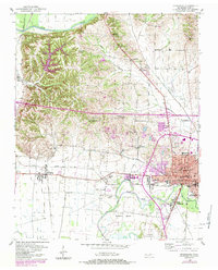
1952 Map of Dyersburg
USGS Topo · Published 1984About this map
The Forked Deer River and its North Fork anchor this mid-century landscape in West Tennessee, where the industrial and residential core of Dyersburg expands eastward. The Illinois Central Gulf railroad serves as a primary transit spine, connecting smaller outlying communities like Finley and Big Bay Junction. This 1952 study, updated in the early 1980s, reveals a rural fabric densely populated with local institutions, including Burdie Chapel Sch and Avery Sch, alongside Numerous country churches like McCullough Chapel and Friendship Ch. The topographical detail captures the varied terrain between the river bottoms and the higher ground to the north near the Obion River. To the south, the Dyersburg Municipal Airport and the developing residential area of South Dyersburg indicate the city's mid-century growth beyond its traditional center.
Find a feature on this map
49 named features on this map. Tap any name to fly to it.
Don’t see what you’re looking for? This feature index may not catch every label — zoom into the map to look around manually.
Map Details
Editions of this 1952 Dyersburg Map
2 editions found
Other maps of this area

1939 · Dyersburg
USGS Topo · 1:62,500

1939 · Hales Point
USGS Topo · 1:62,500

1939 · Caruthersville
USGS Topo · 1:62,500

1939 · Halls
USGS Topo · 1:62,500

1951 · Caruthersville
USGS Topo · 1:62,500

1952 · Hales Point
USGS Topo · 1:62,500

1952 · Bonicord
USGS Topo · 1:24,000

1952 · Newbern
USGS Topo · 1:24,000

1952 · Lane
USGS Topo · 1:24,000

1952 · Dyersburg
USGS Topo · 1:24,000