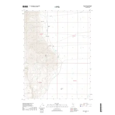
2018 Map of Dyke Canyon
USGS Topo · Published 2018About this map
Dyke sits at the base of the Pine Forest Range in Humboldt County, where the steep terrain of the mountains gives way to the open expanses of the Black Rock Desert. This map illustrates the transition from the high ridges of Sentinel Peak and The Mesa to the desert floor. The landscape is defined by its water sources, which appear as precious anomalies in the arid environment, including Dyke Hot Springs, Whiskey Springs, and Lone Tree Reservoir. Drainage from canyons like Murray Canyon and Buckaroo Canyon feed into the flats, eventually reaching the Quinn River at the edge of the desert. The presence of Woodward RD and Big Creek RD highlights the sparse but essential transportation network that connects these remote points of interest in northern Nevada.
Find a feature on this map
23 named features on this map. Tap any name to fly to it.
Don’t see what you’re looking for? This feature index may not catch every label — zoom into the map to look around manually.
Map Details
Editions of this 2018 Dyke Canyon Map
This is the sole edition of this map. No revisions or reprints were ever made.
Other maps of this area

1886 · Disaster
USGS Topo · 1:250,000

1893 · Disaster
USGS Topo · 1:250,000

1954 · Vya
USGS Topo · 1:250,000

1958 · Vya
USGS Topo · 1:250,000

1961 · Quinn River Crossing
USGS Topo · 1:62,500

1961 · Bottle Creek
USGS Topo · 1:62,500

1962 · Vya
USGS Topo · 1:250,000

1965 · Duffer Peak
USGS Topo · 1:62,500

1972 · Deer Creek Slough
USGS Topo · 1:24,000

1972 · Leonard Cr. Slough North
USGS Topo · 1:24,000