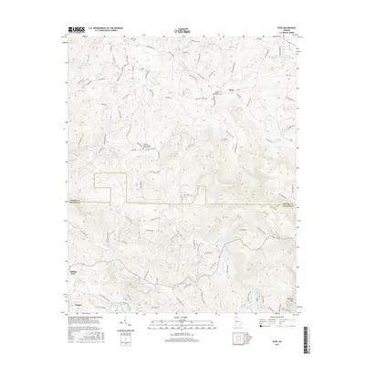
2017 Map of Dyke
USGS Topo · Published 2017About this map
Talking Rock and the surrounding foothills of the Blue Ridge define this portion of North Georgia along the border of Gilmer and Pickens Counties. The landscape is characterized by its narrow valleys and prominent heights like Sharptop Mtn and Andes Ridge, which dictate the winding paths of rural roads and the flow of numerous waterways. The drainage system of Talking Rock Cr and its tributaries, including Price Cr and Clear Cr, has long influenced the settlement patterns and the placement of community centers.
Find a feature on this map
107 named features on this map. Tap any name to fly to it.
Don’t see what you’re looking for? This feature index may not catch every label — zoom into the map to look around manually.
Map Details
Editions of this 2017 Dyke Map
This is the sole edition of this map. No revisions or reprints were ever made.
Other maps of this area

1886 · Dalton
USGS Topo · 1:125,000

1888 · Ellijay
USGS Topo · 1:125,000

1890 · Suwanee
USGS Topo · 1:125,000

1890 · Cartersville
USGS Topo · 1:125,000

1891 · Cartersville
USGS Topo · 1:125,000

1892 · Ellijay
USGS Topo · 1:125,000

1892 · Dalton
USGS Topo · 1:125,000

1894 · Suwanee
USGS Topo · 1:125,000

1896 · Cartersville
USGS Topo · 1:125,000

1897 · Dalton
USGS Topo · 1:125,000