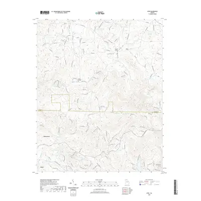
2020 Map of Dyke
USGS Topo · Published 2020About this map
Talking Rock and the settlement of Dyke anchor this 2020 landscape where the Gilmer Co and Pickens Co lines meet. The terrain is defined by the significant elevation of Sharptop Mtn and Andes Ridge, with drainage systems like Talking Rock Cr and Price Cr carving through the mountain gaps. Rural life is centered around long-standing community landmarks such as the Pleasant Valley Baptist Church Cem and Clear Creek Baptist Church Cem, providing critical points of interest for genealogists. Numerous private and recreational water bodies, including Diamond Lure Lake, Teague Lake, and Jones Lake, are connected by a network of winding mountain roads like Blackberry Mountain Rd and Burnt Mountain Rd. The map illustrates a contemporary mountain community where development is closely tied to the natural contours of the North Georgia ridges.
Find a feature on this map
120 named features on this map. Tap any name to fly to it.
Don’t see what you’re looking for? This feature index may not catch every label — zoom into the map to look around manually.
Map Details
Editions of this 2020 Dyke Map
This is the sole edition of this map. No revisions or reprints were ever made.
Other maps of this area

1886 · Dalton
USGS Topo · 1:125,000

1888 · Ellijay
USGS Topo · 1:125,000

1890 · Suwanee
USGS Topo · 1:125,000

1890 · Cartersville
USGS Topo · 1:125,000

1891 · Cartersville
USGS Topo · 1:125,000

1892 · Ellijay
USGS Topo · 1:125,000

1892 · Dalton
USGS Topo · 1:125,000

1894 · Suwanee
USGS Topo · 1:125,000

1896 · Cartersville
USGS Topo · 1:125,000

1897 · Dalton
USGS Topo · 1:125,000