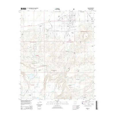
2014 Map of Eagar
USGS Topo · Published 2014About this map
The neighboring settlements of Eagar and Springerville serve as the hub of this high-elevation landscape, situated within the fertile Round Valley. Water management is central to the local economy, as evidenced by the presence of Amity Ditch and Big Ditch, which divert water from the Little Colorado River to support agriculture. To the south, the terrain rises into the Apache National Forest, where a dense network of forest roads and namesake features like Saffell Canyon and Milligan Valley dominate the landscape. Evidence of the area's pioneer heritage persists in road names like Old Grist Mill Rd, while modern developments include the Springerville Municipal Airport and the Athletic Dome. This survey shows the interface between these established communities and the surrounding mountain wilderness, featuring numerous stock tanks and springs scattered through the canyons.
Find a feature on this map
113 named features on this map. Tap any name to fly to it.
Don’t see what you’re looking for? This feature index may not catch every label — zoom into the map to look around manually.
Map Details
Editions of this 2014 Eagar Map
This is the sole edition of this map. No revisions or reprints were ever made.
Other maps of this area

1886 · St Johns
USGS Topo · 1:250,000

1892 · St Johns
USGS Topo · 1:250,000

1922 · Nutrioso
USGS Topo · 1:125,000

1954 · Clifton
USGS Topo · 1:250,000

1954 · Saint Johns
USGS Topo · 1:250,000

1957 · Clifton
USGS Topo · 1:250,000

1957 · Saint Johns
USGS Topo · 1:250,000

1958 · Clifton
USGS Topo · 1:250,000

1958 · Saint Johns
USGS Topo · 1:250,000

1958 · Alpine
USGS Topo · 1:62,500