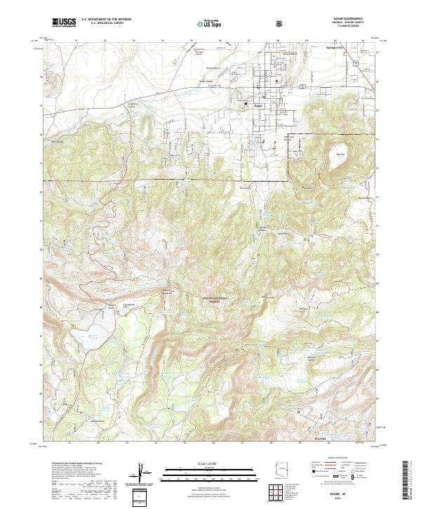
2021 Map of Eagar
USGS Topo · Published 2021About this map
Eagar and Springerville serve as the primary hubs in this high-altitude landscape where the Little Colorado River winds through Round Valley. The map details an intricate network of irrigation and water management essential to the region, including the Amity Ditch, Saffell tank, and numerous family-named water sources like Robertson Tank and Henry Slade Spring. Moving south into the Apache National Forest, the terrain shifts from the gridded streets of town to a complex geography of draws and knolls, including Joe Baca Draw, Milligan Knoll, and the distinctive Flat Top mesa.
Find a feature on this map
137 named features on this map. Tap any name to fly to it.
Don’t see what you’re looking for? This feature index may not catch every label — zoom into the map to look around manually.
Map Details
Editions of this 2021 Eagar Map
This is the sole edition of this map. No revisions or reprints were ever made.
Other maps of this area

1886 · St Johns
USGS Topo · 1:250,000

1892 · St Johns
USGS Topo · 1:250,000

1922 · Nutrioso
USGS Topo · 1:125,000

1954 · Clifton
USGS Topo · 1:250,000

1954 · Saint Johns
USGS Topo · 1:250,000

1957 · Clifton
USGS Topo · 1:250,000

1957 · Saint Johns
USGS Topo · 1:250,000

1958 · Clifton
USGS Topo · 1:250,000

1958 · Saint Johns
USGS Topo · 1:250,000

1958 · Alpine
USGS Topo · 1:62,500