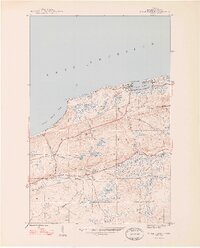
1948 Map of Eagle Harbor
USGS Topo · Published 1948About this map
Lake Superior shorelines define this 1948 survey of Keweenaw County, where the rugged maritime and mining history of the Upper Peninsula is etched into the landscape. The village of Eagle Harbor serves as the primary coastal anchor, featuring a prominent Coast Guard Sta and LH beacon guarding the rocky inlet. Inland, the map reveals the era's transition from active industrial extraction to a burgeoning scenic destination, notably along the winding Brockway Mountain Drive and the ridges overlooking Great Sand Bay.
Find a feature on this map
36 named features on this map. Tap any name to fly to it.
Don’t see what you’re looking for? This feature index may not catch every label — zoom into the map to look around manually.
Map Details
Editions of this 1948 Eagle Harbor Map
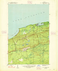
2 editions found
Other maps of this area

1938 · Bruneau Creek
USGS Topo · 1:31,680

1938 · Delaware
USGS Topo · 1:31,680

1939 · Deer Lake
USGS Topo · 1:31,680

1939 · Delaware
USGS Topo · 1:31,680

1940 · Deer Lake
USGS Topo · 1:31,680

1940 · Central
USGS Topo · 1:31,680

1941 · Mohawk
USGS Topo · 1:31,680

1946 · Phoenix
USGS Topo · 1:24,000

1946 · Bruneau Creek
USGS Topo · 1:24,000

1946 · Mohawk
USGS Topo · 1:24,000
Featured Places
- Eagle Harbor, MI
- Houghton Township, MI
- Nepco Camp Number 7, MI
- Copper Falls, MI
- Eagle Harbor Township, MI