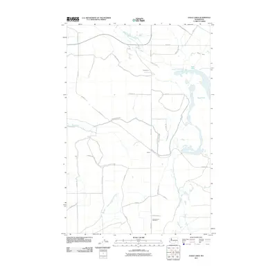
2011 Map of Eagle Lakes
USGS Topo · Published 2011About this map
The Eagle Lakes and the agricultural lands of Franklin County are defined here by a sophisticated water management network designed for the arid interior of Washington. The Wahluke Branch Canal winds through the landscape, supported by the Wahluke Siphon to the northeast, illustrating the massive engineering efforts required to sustain farming in this region. Settlement is centered around the community of Sagehill, while the Bailie Memorial Boys Ranch sits to the south along Sagehill Rd. The road network follows both the section lines and the natural contours of the basin, with local family-named routes like S Athey Rd and Mound Rd providing access to the various farm plots and irrigation infrastructure. This 2011 survey captures the area at a peak of modern irrigation development, showing the transition from desert terrain to a productive agricultural grid.
Find a feature on this map
32 named features on this map. Tap any name to fly to it.
Don’t see what you’re looking for? This feature index may not catch every label — zoom into the map to look around manually.
Map Details
Editions of this 2011 Eagle Lakes Map
This is the sole edition of this map. No revisions or reprints were ever made.
Other maps of this area

1923 · Corfu
USGS Topo · 1:62,500

1924 · Othello
USGS Topo · 1:62,500

1924 · Hanford
USGS Topo · 1:62,500

1925 · Scooteney Lake
USGS Topo · 1:62,500

1951 · Scooteney Lake
USGS Topo · 1:62,500

1951 · Corfu
USGS Topo · 1:62,500

1951 · Hanford
USGS Topo · 1:62,500

1953 · Walla Walla
USGS Topo · 1:250,000

1954 · Bruce
USGS Topo · 1:24,000

1954 · Othello
USGS Topo · 1:24,000