
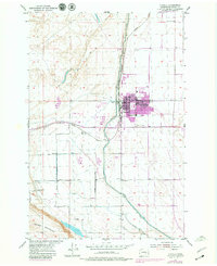
1954 Map of Othello
USGS Topo · Published 1956About this map
Othello stands as a focal point of irrigation and rail infrastructure in the mid-1950s, defined by the extensive reach of the Potholes East Canal system. This era marks the transformation of the Columbia Basin, where engineered waterways like the East Chicago Milwaukee St Paul and Pacific Canal parallel the vital Chicago Milwaukee St Paul and Pacific railroad line. The town's grid is established around Main St and Broadway Ave, supported by local institutions such as Lutacaga Sch and Othello Sch. To the south, the terrain rises sharply into the Saddle Mountains, while the surrounding landscape is marked by a network of family-named thoroughfares including Barker Road, Thacker Road, and Mc Kinney Road. The map also captures mid-century social markers, from the Adams Cemetery to the north in Novara to a local Drive-in Theater on the outskirts of the settlement.
Find a feature on this map
27 named features on this map. Tap any name to fly to it.
Don’t see what you’re looking for? This feature index may not catch every label — zoom into the map to look around manually.
Map Details
Editions of this 1954 Othello Map
2 editions found
Other maps of this area

1923 · Corfu
USGS Topo · 1:62,500

1924 · Othello
USGS Topo · 1:62,500

1924 · Hanford
USGS Topo · 1:62,500

1925 · Scooteney Lake
USGS Topo · 1:62,500

1951 · Scooteney Lake
USGS Topo · 1:62,500

1951 · Corfu
USGS Topo · 1:62,500

1951 · Hanford
USGS Topo · 1:62,500

1953 · Walla Walla
USGS Topo · 1:250,000

1954 · Bruce
USGS Topo · 1:24,000

1954 · Warden
USGS Topo · 1:24,000