
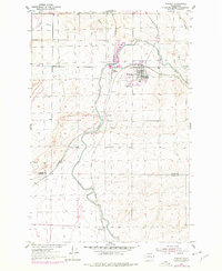
1954 Map of Warden
USGS Topo · Published 1956About this map
Warden serves as the focal point of this mid-1950s survey, situated at a major crossing of the Northern Pacific and the Chicago Milwaukee St Paul and Pacific railroads. This intersection, along with the adjacent West Warden, illustrates the town's role as a transportation and logistics hub for the surrounding Columbia Basin. The landscape is defined by the massive irrigation infrastructure of the East Low Canal, which winds through the territory and utilizes a large Siphon to navigate the terrain south of town. Beyond the residential grid, the map records industrial and agricultural markers such as a Quarry, a Gravel Pit, and the small settlement of Simenson near the southern border of Grant and Adams County. This survey captures the region just as the expansion of the canal system was fundamentally reshaping the local geography and economy.
Find a feature on this map
15 named features on this map. Tap any name to fly to it.
Don’t see what you’re looking for? This feature index may not catch every label — zoom into the map to look around manually.
Map Details
Editions of this 1954 Warden Map
2 editions found
Other maps of this area

1916 · Connell
USGS Topo · 1:125,000

1918 · Connell
USGS Topo · 1:125,000

1923 · Wheeler
USGS Topo · 1:62,500

1924 · Othello
USGS Topo · 1:62,500

1925 · Wheeler
USGS Topo · 1:62,500

1925 · Schrag
USGS Topo · 1:62,500

1953 · Walla Walla
USGS Topo · 1:250,000

1953 · Ritzville
USGS Topo · 1:250,000

1954 · Bruce
USGS Topo · 1:24,000

1954 · Soda Lake
USGS Topo · 1:24,000