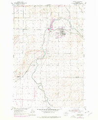
1954 Map of Warden
USGS Topo · Published 1978About this map
Agricultural development and industrial infrastructure define the landscape around Warden in the mid-1950s. This survey, updated with revisions from the late 1970s, illustrates the critical role of water management in Grant County through the sprawling East Low Canal, Aqueduct segments, and a massive Siphon engineering feature. The town itself serves as a hub for the C M St P & P railroad, which cuts across the terrain to connect local settlements like West Warden and Simenson. Local life is anchored by the Warden Sch and nearby Cem, while the area's economic activity is evidenced by a Quarry and Gravel Pit. The natural drainage of Lind Coulee provides a stark contrast to the modern, straight-lined irrigation canals that transformed this semi-arid region into a productive farming district.
Find a feature on this map
19 named features on this map. Tap any name to fly to it.
Don’t see what you’re looking for? This feature index may not catch every label — zoom into the map to look around manually.
Map Details
Editions of this 1954 Warden Map
2 editions found
Other maps of this area

1916 · Connell
USGS Topo · 1:125,000

1918 · Connell
USGS Topo · 1:125,000

1923 · Wheeler
USGS Topo · 1:62,500

1924 · Othello
USGS Topo · 1:62,500

1925 · Wheeler
USGS Topo · 1:62,500

1925 · Schrag
USGS Topo · 1:62,500

1953 · Walla Walla
USGS Topo · 1:250,000

1953 · Ritzville
USGS Topo · 1:250,000

1954 · Bruce
USGS Topo · 1:24,000

1954 · Warden
USGS Topo · 1:24,000