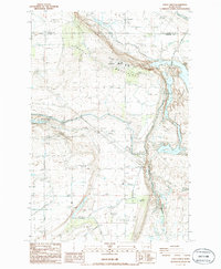
1986 Map of Eagle Lakes
USGS Topo · Published 1986About this map
The Othello Air Force Sta and Radar Hill dominate the northern landscape of this mid-1980s survey, marking a period where military infrastructure and agricultural engineering intersected in central Washington. Situated along the boundary of Adams and Franklin counties, the area is defined by the ridge of the Saddle Mountains and the intricate water management system that feeds the desert. The presence of the Eagle Lake Substation, various Pumping Stations, and the Wasteway illustrates the massive scale of the irrigation projects required to support the region. Down in the basin, Eagle Lakes provides a contrast to the high desert terrain, buffered by the Wahluke Slope Habitat Management Area. This map also documents local social landmarks such as the Baillie Memorial Boys Ranch, offering a detailed view of both the physical and human geography of this high-desert corridor.
Find a feature on this map
22 named features on this map. Tap any name to fly to it.
Don’t see what you’re looking for? This feature index may not catch every label — zoom into the map to look around manually.
Map Details
Editions of this 1986 Eagle Lakes Map
This is the sole edition of this map. No revisions or reprints were ever made.
Other maps of this area

1923 · Corfu
USGS Topo · 1:62,500

1924 · Othello
USGS Topo · 1:62,500

1924 · Hanford
USGS Topo · 1:62,500

1925 · Scooteney Lake
USGS Topo · 1:62,500

1951 · Scooteney Lake
USGS Topo · 1:62,500

1951 · Corfu
USGS Topo · 1:62,500

1951 · Hanford
USGS Topo · 1:62,500

1953 · Walla Walla
USGS Topo · 1:250,000

1954 · Bruce
USGS Topo · 1:24,000

1954 · Othello
USGS Topo · 1:24,000