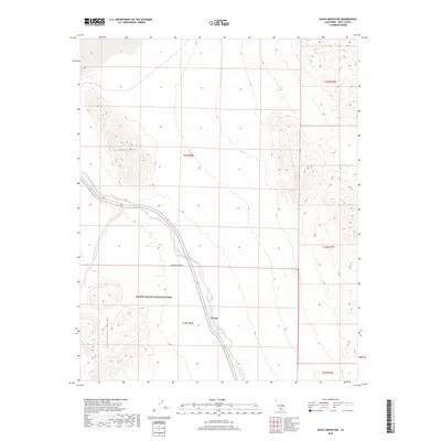
2018 Map of Eagle Mountain
USGS Topo · Published 2018About this map
Death Valley National Park encompasses much of this desert landscape, where the ephemeral Amargosa River cuts through the arid basin. The small settlement of Evelyn sits along Highway 127, representing a rare pocket of human habitation in a region dominated by prominent geological features. Elevation changes are marked by the Eagle Mtn peak and the foothills of the Greenwater Range to the southwest. This 2018 survey illustrates the vast emptiness of the Mojave Desert and the modern road network that provides access through this corridor between mountain ranges. The mapping detail highlights the contrast between the low-lying river wash and the rising topography of the surrounding desert uplands.
Find a feature on this map
12 named features on this map. Tap any name to fly to it.
Don’t see what you’re looking for? This feature index may not catch every label — zoom into the map to look around manually.
Map Details
Editions of this 2018 Eagle Mountain Map
This is the sole edition of this map. No revisions or reprints were ever made.
Other maps of this area

1908 · Furnace Creek
USGS Topo · 1:250,000

1910 · Furnace Creek
USGS Topo · 1:250,000

1940 · Eagle Tank
USGS Topo · 1:62,500

1948 · Death Valley
USGS Topo · 1:250,000

1951 · Eagle Mtn
USGS Topo · 1:62,500

1952 · Ash Meadows
USGS Topo · 1:62,500

1954 · Death Valley
USGS Topo · 1:250,000

1956 · Death Valley
USGS Topo · 1:250,000

1957 · Death Valley
USGS Topo · 1:250,000

1958 · Death Valley
USGS Topo · 1:250,000