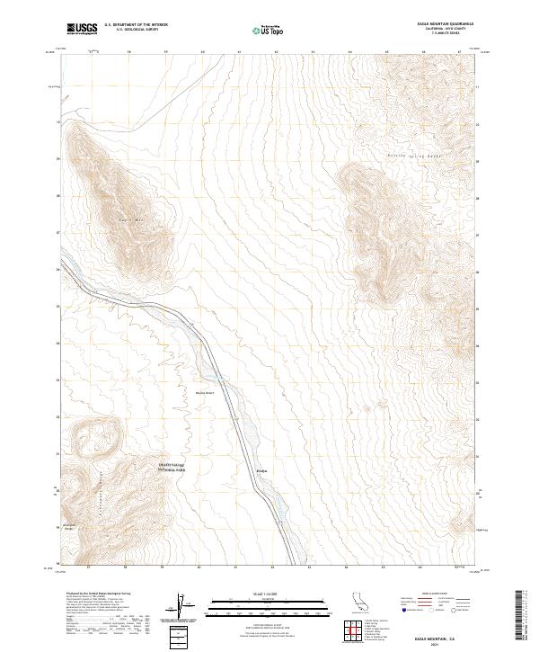
2021 Map of Eagle Mountain
USGS Topo · Published 2021About this map
The Amargosa River cuts through the arid landscape of the Mojave Desert on this 2021 study, following the path of Highway 127. This region, located within the eastern boundaries of Death Valley National Park, is defined by the dramatic convergence of several mountain chains, including the Amargosa Range, Greenwater Range, and the Resting Spring Range. The settlement of Evelyn sits at a narrow point in the river valley, marking a historically significant location for travelers moving through this corridor between the ranges.
Find a feature on this map
14 named features on this map. Tap any name to fly to it.
Don’t see what you’re looking for? This feature index may not catch every label — zoom into the map to look around manually.
Map Details
Editions of this 2021 Eagle Mountain Map
This is the sole edition of this map. No revisions or reprints were ever made.
Other maps of this area

1908 · Furnace Creek
USGS Topo · 1:250,000

1910 · Furnace Creek
USGS Topo · 1:250,000

1940 · Eagle Tank
USGS Topo · 1:62,500

1948 · Death Valley
USGS Topo · 1:250,000

1951 · Eagle Mtn
USGS Topo · 1:62,500

1952 · Ash Meadows
USGS Topo · 1:62,500

1954 · Death Valley
USGS Topo · 1:250,000

1956 · Death Valley
USGS Topo · 1:250,000

1957 · Death Valley
USGS Topo · 1:250,000

1958 · Death Valley
USGS Topo · 1:250,000