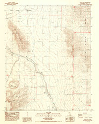
1988 Map of Eagle Mtn.
USGS Topo · Published 1988About this map
The Amargosa Desert landscape in the late 1980s is defined by its arid valley floors and stark mountain borders. The Amargosa River courses through the center of the sheet, flanked by an Old Railroad Grade that provides a tangible link to the region's former transportation corridors. This corridor passes through the location of Evelyn (Site), a former stop along the valley floor. To the east, the Resting Spring Range rises sharply, while the western and southern boundaries are shaped by Eagle Mountain and the Greenwater Range. Numerous scattered Prospects and individual Prospect labels indicate a history of mineral exploration across the slopes. The presence of Mud & Alkali flats in the north underscores the ephemeral nature of water in this desert environment, where drainage patterns are often seasonal or dry.
Find a feature on this map
14 named features on this map. Tap any name to fly to it.
Don’t see what you’re looking for? This feature index may not catch every label — zoom into the map to look around manually.
Map Details
Editions of this 1988 Eagle Mtn. Map
This is the sole edition of this map. No revisions or reprints were ever made.
Other maps of this area

1908 · Furnace Creek
USGS Topo · 1:250,000

1910 · Furnace Creek
USGS Topo · 1:250,000

1940 · Eagle Tank
USGS Topo · 1:62,500

1948 · Death Valley
USGS Topo · 1:250,000

1951 · Eagle Mtn
USGS Topo · 1:62,500

1952 · Ash Meadows
USGS Topo · 1:62,500

1954 · Death Valley
USGS Topo · 1:250,000

1956 · Death Valley
USGS Topo · 1:250,000

1957 · Death Valley
USGS Topo · 1:250,000

1958 · Death Valley
USGS Topo · 1:250,000