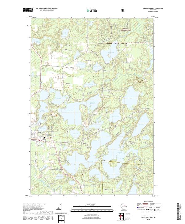
2022 Map of Eagle River East
USGS Topo · Published 2022About this map
The Vilas County Courthouse stands as a central landmark in this northern lake country, where the settlement of Eagle River is surrounded by a dense network of glacial waters and woods. This survey details a complex aquatic landscape, featuring the sprawling Eagle Lake and Catfish Lake, which are linked to other water bodies like Scattering Rice Lake and Yellow Birch Lake. The transition from the town's grid to the natural contours of the Nicolet National Forest in the northeast highlights the area's dual character as a county seat and a premier recreation destination.
Find a feature on this map
144 named features on this map. Tap any name to fly to it.
Don’t see what you’re looking for? This feature index may not catch every label — zoom into the map to look around manually.
Map Details
Editions of this 2022 Eagle River East Map
This is the sole edition of this map. No revisions or reprints were ever made.
Other maps of this area

1928 · Three Lakes
USGS Topo · 1:48,000

1930 · Robbins
USGS Topo · 1:48,000

1938 · Phelps
USGS Topo · 1:48,000

1938 · Three Lakes
USGS Topo · 1:48,000

1938 · Robbins
USGS Topo · 1:48,000

1945 · Three Lakes
USGS Topo · 1:48,000

1945 · Robbins
USGS Topo · 1:48,000

1946 · Star Lake
USGS Topo · 1:48,000

1950 · Phelps
USGS Topo · 1:48,000

1950 · Star Lake
USGS Topo · 1:48,000