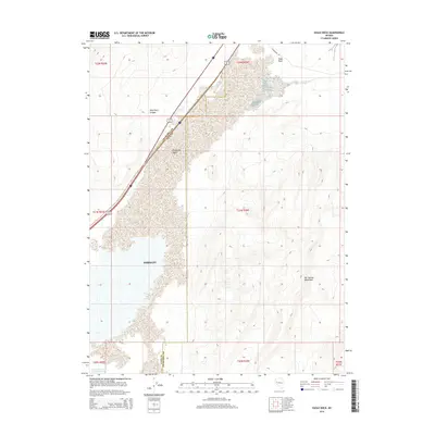
2014 Map of Eagle Rock
USGS Topo · Published 2014About this map
The Fortymile Desert dominates this arid landscape at the junction of Churchill and Lyon Counties, a region defined by its harsh environmental history and vital transportation corridors. The western portion of the map is occupied by Fernley, where infrastructure like Fernley Reservoir Number Three supports the community in the high desert. To the east, the topography rises sharply into the Hot Springs Mountains, providing a stark contrast to the low-lying alkali flats. Traces of historical transit are visible along the northern edge, where Old Highway 40 skirts the base of the distinctive Eagle Rock formation. This 2014 survey documents the convergence of modern high-speed travel, represented by Interstate 80 and Alt 95, with the rugged natural barriers that once challenged pioneers traversing Miry Place Canyon.
Find a feature on this map
18 named features on this map. Tap any name to fly to it.
Don’t see what you’re looking for? This feature index may not catch every label — zoom into the map to look around manually.
Map Details
Editions of this 2014 Eagle Rock Map
This is the sole edition of this map. No revisions or reprints were ever made.
Other maps of this area

1890 · Wadsworth
USGS Topo · 1:125,000

1892 · Wadsworth
USGS Topo · 1:125,000

1894 · Wadsworth
USGS Topo · 1:125,000

1908 · Carson Sink
USGS Topo · 1:250,000

1910 · Carson Sink
USGS Topo · 1:250,000

1951 · Soda Lake
USGS Topo · 1:62,500

1951 · Desert Peak
USGS Topo · 1:62,500

1957 · Fireball Ridge
USGS Topo · 1:62,500

1957 · Two Tips
USGS Topo · 1:62,500

1957 · Reno
USGS Topo · 1:250,000