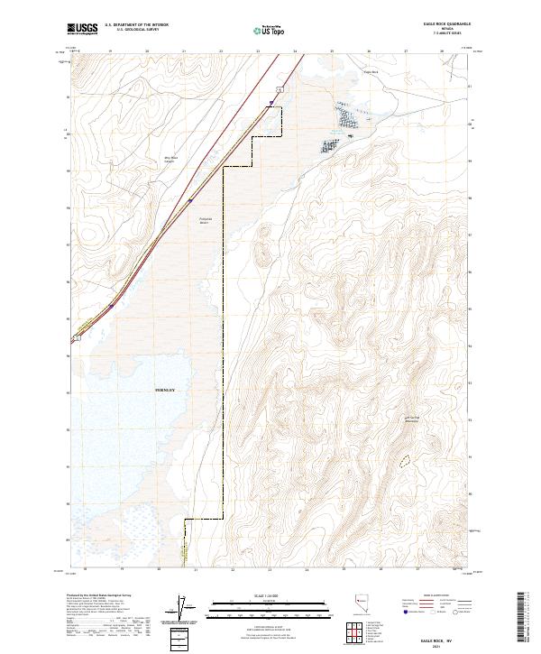
2021 Map of Eagle Rock
USGS Topo · Published 2021About this map
Eagle Salt Works Spring stands as a notable landmark in this arid landscape, signaling the historical importance of mineral extraction in the high desert of Nevada. The terrain is defined by the stark transition from the Fortymile Desert in the west to the elevated topography of the Hot Springs Mountains in the east. Along the western edge, the boundaries of Fernley and the junction of Churchill and Lyon Counties suggest the proximity of regional growth and transport, specifically via the Alt 95 corridor. Land features such as Eagle Rock and Miry Place Canyon provide essential orientation in a region where water sources and topography dictated the paths of early travel and industry. This survey by the U.S. Geological Survey captures the modern state of these desert landforms and historical sites within the Great Basin.
Find a feature on this map
16 named features on this map. Tap any name to fly to it.
Don’t see what you’re looking for? This feature index may not catch every label — zoom into the map to look around manually.
Map Details
Editions of this 2021 Eagle Rock Map
This is the sole edition of this map. No revisions or reprints were ever made.
Other maps of this area

1890 · Wadsworth
USGS Topo · 1:125,000

1892 · Wadsworth
USGS Topo · 1:125,000

1894 · Wadsworth
USGS Topo · 1:125,000

1908 · Carson Sink
USGS Topo · 1:250,000

1910 · Carson Sink
USGS Topo · 1:250,000

1951 · Soda Lake
USGS Topo · 1:62,500

1951 · Desert Peak
USGS Topo · 1:62,500

1957 · Fireball Ridge
USGS Topo · 1:62,500

1957 · Two Tips
USGS Topo · 1:62,500

1957 · Reno
USGS Topo · 1:250,000