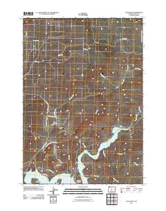
2011 Map of Eagle Rock
USGS Topo · Published 2011About this map
Prineville Reservoir dominates the southern landscape of this Crook County region, where the impounded Crooked River winds through the high desert terrain. The area's ranching heritage is evidenced by family-named landmarks such as Way Ranch, Carey Ranch, and Klaus Ranch, which dot the drainages of Owl Creek and Antelope Creek. The Paulina Hwy serves as the primary artery, tracing a path past the prominent Eagle Rock and the high expanse of Combs Flat. At the water's edge, the Prineville Reservoir Resort and Big Bend Island highlight the importance of the reservoir for recreation. This 2011 survey illustrates a specialized network of roads including SE Juniper Canyon Rd and SE Antelope Creek Dr, reflecting modern residential and access patterns within this traditional livestock and watershed corridor.
Find a feature on this map
34 named features on this map. Tap any name to fly to it.
Don’t see what you’re looking for? This feature index may not catch every label — zoom into the map to look around manually.
Map Details
Editions of this 2011 Eagle Rock Map
This is the sole edition of this map. No revisions or reprints were ever made.
Other maps of this area

1946 · Eagle Rock
USGS Topo · 1:62,500

1948 · Eagle Rock
USGS Topo · 1:62,500

1948 · Ochoco Reservoir
USGS Topo · 1:62,500

1950 · Ochoco Reservoir
USGS Topo · 1:62,500

1955 · Bend
USGS Topo · 1:250,000

1957 · Bend
USGS Topo · 1:250,000

1958 · Bend
USGS Topo · 1:250,000

1962 · Prineville
USGS Topo · 1:24,000

1962 · Powell Buttes
USGS Topo · 1:62,500

1962 · Prineville
USGS Topo · 1:62,500