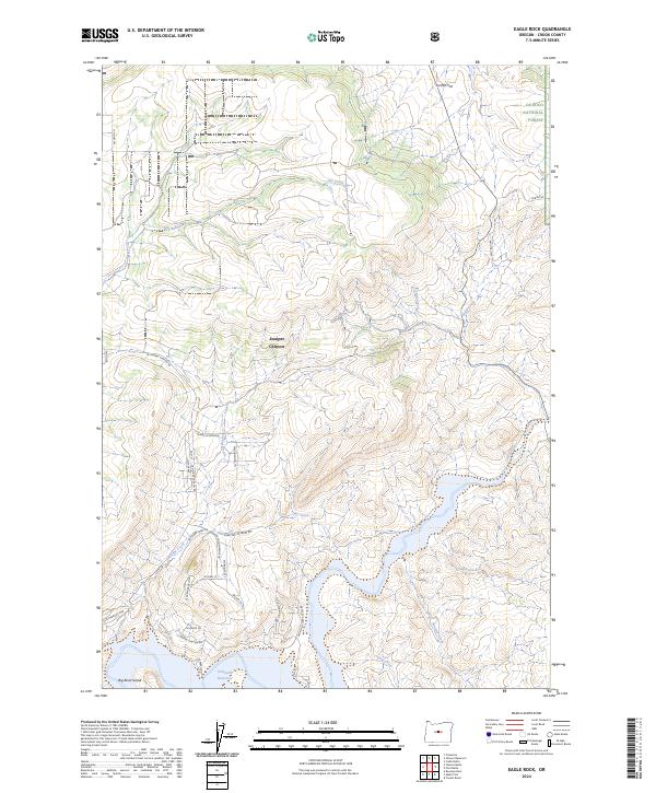
2024 Map of Eagle Rock
USGS Topo · Published 2024About this map
Prineville Reservoir and its surrounding canyonlands define this modern survey of Crook County. The southern portion of the map is dominated by the reservoir and the winding course of the Crooked River, while the northern landscape transitions into the Ochoco National Forest. This area shows a distinct contrast between the protected federal lands and the increasing residential development creeping up through Juniper Canyon along roads like SE Juniper Canyon Rd and S Juniper Canyon Rd.
Find a feature on this map
37 named features on this map. Tap any name to fly to it.
Don’t see what you’re looking for? This feature index may not catch every label — zoom into the map to look around manually.
Map Details
Editions of this 2024 Eagle Rock Map
This is the sole edition of this map. No revisions or reprints were ever made.
Other maps of this area

1946 · Eagle Rock
USGS Topo · 1:62,500

1948 · Eagle Rock
USGS Topo · 1:62,500

1948 · Ochoco Reservoir
USGS Topo · 1:62,500

1950 · Ochoco Reservoir
USGS Topo · 1:62,500

1955 · Bend
USGS Topo · 1:250,000

1957 · Bend
USGS Topo · 1:250,000

1958 · Bend
USGS Topo · 1:250,000

1962 · Prineville
USGS Topo · 1:24,000

1962 · Powell Buttes
USGS Topo · 1:62,500

1962 · Prineville
USGS Topo · 1:62,500