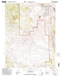
1994 Map of Eagle Rock
USGS Topo · Published 1998About this map
Baker Mtn and its namesake Baker Gulch dominate the central high ground of this section of the Pike National Forest. The landscape is defined by a dense network of drainages and seasonal water sources, including Berkey Spring, Harriman Spring, and Willow Spring. Human presence is concentrated near the National Forest Boundary and the northeastern corner, where the Paige Ranch sits just below the Tarryall Reservoir State Wildlife Area. Access through the varied terrain is provided by established routes like Remington Road and Elkhorn Road, which bridge the gap between the protected forest lands and the more open valley floors. The map details a transition from the high peaks like Eagle Rock down to the lower reaches of Ruby Gulch and Chase Gulch.
Find a feature on this map
23 named features on this map. Tap any name to fly to it.
Don’t see what you’re looking for? This feature index may not catch every label — zoom into the map to look around manually.
Map Details
Editions of this 1994 Eagle Rock Map
2 editions found
Other maps of this area

1937 · Como
USGS Topo · 1:62,500

1953 · Denver
USGS Topo · 1:250,000

1956 · Eagle Rock
USGS Topo · 1:24,000

1956 · Elkhorn
USGS Topo · 1:24,000

1956 · Sulphur Mountain
USGS Topo · 1:24,000

1956 · Farnum Peak
USGS Topo · 1:24,000

1956 · Hartsel
USGS Topo · 1:24,000

1956 · Glentivar
USGS Topo · 1:24,000

1957 · Denver
USGS Topo · 1:250,000
1957 · Milligan Lakes
USGS Topo · 1:24,000