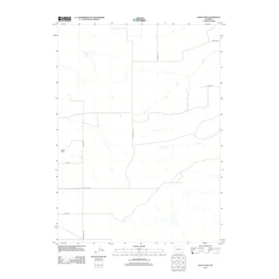
2012 Map of Eagles Nest
USGS Topo · Published 2012About this map
Eagles Nest anchors this high plains landscape in Goshen County, where the high prairie begins to give way to the drainage systems of the North Platte region. This 2012 survey by the U.S. Geological Survey documents a remote corner of Wyoming defined by its ephemeral water sources and a network of named county roads that follow the contours of the land. Cottonwood Falls Spring provides a rare reliable water point in the northwestern quadrant, feeding into the upper reaches of Deer Cr, which meanders across the territory alongside Cherry Cr.
Find a feature on this map
12 named features on this map. Tap any name to fly to it.
Don’t see what you’re looking for? This feature index may not catch every label — zoom into the map to look around manually.
Map Details
Editions of this 2012 Eagles Nest Map
This is the sole edition of this map. No revisions or reprints were ever made.
Other maps of this area

1896 · Hartville
USGS Topo · 1:125,000

1901 · Hartville
USGS Topo · 1:125,000

1950 · Rockeagle
USGS Topo · 1:24,000

1950 · Fort Laramie
USGS Topo · 1:24,000

1950 · Register Cliff
USGS Topo · 1:24,000

1951 · Antelope Gap
USGS Topo · 1:24,000
1951 · Wheatland NE
USGS Topo · 1:24,000

1951 · Eagles Nest
USGS Topo · 1:24,000

1952 · Register Cliff
USGS Topo · 1:24,000

1952 · Fort Laramie
USGS Topo · 1:24,000