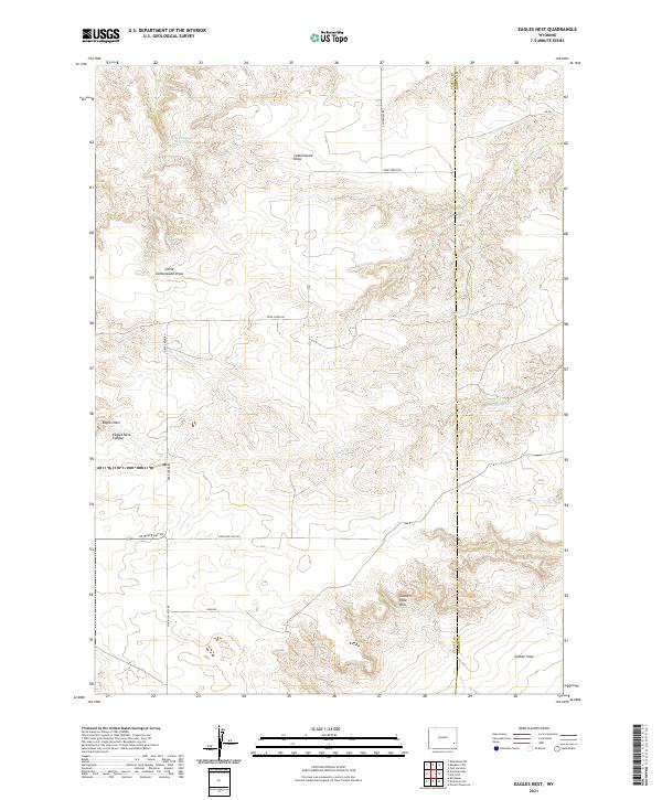
2021 Map of Eagles Nest
USGS Topo · Published 2021About this map
Goshen Hole defines the southeastern landscape of this modern Wyoming survey, where the dramatic elevation change at the Goshen Hole Rim transitions into the plains of the Platte and Goshen county line. The western portion of the map is dominated by the namesake Eagles Nest and the deep incision of Eagles Nest Canyon. This area is characterized by sparse ranching infrastructure and a network of named rural routes, including Antelope Gap Rd and Swan Rd, which navigate the high-desert terrain.
Find a feature on this map
20 named features on this map. Tap any name to fly to it.
Don’t see what you’re looking for? This feature index may not catch every label — zoom into the map to look around manually.
Map Details
Editions of this 2021 Eagles Nest Map
This is the sole edition of this map. No revisions or reprints were ever made.
Other maps of this area

1896 · Hartville
USGS Topo · 1:125,000

1901 · Hartville
USGS Topo · 1:125,000

1950 · Rockeagle
USGS Topo · 1:24,000

1950 · Fort Laramie
USGS Topo · 1:24,000

1950 · Register Cliff
USGS Topo · 1:24,000

1951 · Antelope Gap
USGS Topo · 1:24,000
1951 · Wheatland NE
USGS Topo · 1:24,000

1951 · Eagles Nest
USGS Topo · 1:24,000

1952 · Register Cliff
USGS Topo · 1:24,000

1952 · Fort Laramie
USGS Topo · 1:24,000