1963 Map of Eagleville
USGS Topo · Published 1965About this map
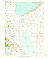
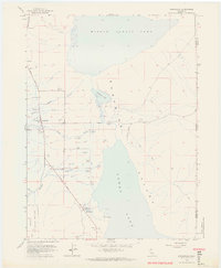
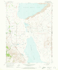
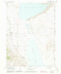
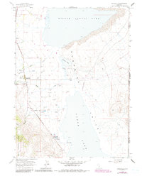
Surprise Valley defines the landscape of this 1960s survey, where the arid basin floor meets the rising slopes of the Modoc National Forest. The settlement of Eagleville sits at the western edge of the valley, a hub of local activity supported by a series of creeks including Raider Creek, Eagle Creek, and Owl Creek. The hydrology of the area is particularly detailed, showing a complex system of flowing wells and hot springs that sustain ranching life on the fringes of the massive Middle Alkali Lake and Lower Alkali Lake.
Find a feature on this map
32 named features on this map. Tap any name to fly to it.
Don’t see what you’re looking for? This feature index may not catch every label — zoom into the map to look around manually.
Map Details
Editions of this 1963 Eagleville Map
5 editions found
Other maps of this area

1886 · Alturas
USGS Topo · 1:250,000

1889 · Long Valley
USGS Topo · 1:250,000

1892 · Alturas
USGS Topo · 1:250,000

1954 · Vya
USGS Topo · 1:250,000

1954 · Alturas
USGS Topo · 1:250,000

1958 · Alturas
USGS Topo · 1:250,000

1958 · Vya
USGS Topo · 1:250,000

1962 · Alturas
USGS Topo · 1:250,000

1962 · Vya
USGS Topo · 1:250,000
1962 · Snake Lake
USGS Topo · 1:24,000