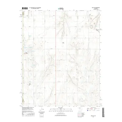
2016 Map of Eakly NE
USGS Topo · Published 2016About this map
Ghost Mound and the Twin Mounds dominate the southwestern reaches of this survey, where the border of Washita and Caddo Counties meets. This part of the Oklahoma interior is defined by a complex network of managed water resources, including Cartwright Reservoir and several sites along the Cobb Creek watershed. The drainage patterns of Fivemile Creek and Lake Creek carve through the landscape, creating the deep recesses of Cedar Canyon.
Find a feature on this map
44 named features on this map. Tap any name to fly to it.
Don’t see what you’re looking for? This feature index may not catch every label — zoom into the map to look around manually.
Map Details
Editions of this 2016 Eakly NE Map
This is the sole edition of this map. No revisions or reprints were ever made.
Other maps of this area

1942 · Geary
USGS Topo · 1:62,500

1951 · Binger
USGS Topo · 1:62,500

1955 · Clinton
USGS Topo · 1:250,000

1957 · Clinton
USGS Topo · 1:250,000

1961 · Eakly
USGS Topo · 1:62,500

1964 · Weatherford
USGS Topo · 1:62,500

1979 · Sickles
USGS Topo · 1:24,000
1979 · Rock Mary
USGS Topo · 1:24,000
1979 · Bridgeport
USGS Topo · 1:24,000

1984 · Eakly
USGS Topo · 1:24,000